Banner 2013

Banner 2013

Monday, 4 November 2013

Day 7 - rest day


Today was a rest day for many of the group, although some did stay at the hotel working on finds and administration for the rest of the season. Sadly, they have missed out on trips or being able to relax today, so a big thank you to all those who did this today and who work in the evenings and at other times to help keep the project running smoothly. We really appreciate it.

Some of us went into Petra to visit the ancient city. This is a vast complex of Nabatean and Roman buildings and religious places, built into the rocky cliffs near Wadi Musa. To approach the city one must make the long descent down the Siq, which in it's outer part is an exposed and dusty track but quickly turns into a long, narrow crack in the rock with steep sides and either rocky or stone covered footing.  

At the end of the Siq the bright light shines through the crack in the cliff to reveal The Treasury - Al Khazneh - which is a truly fantastic sight. 

The pictures below can tell the story of Petra today, and largely reflect one of the main circular routes to a significant feature - The High Place of Sacrifice. The high place is indeed high and classified as a 'hard' climb, and today it was extremely windy on the top. Carrying on and round past the tea stop which is near the summit, one route down also passes other Petra landmarks such as the two obelisks, the triclinium, the soldier's tomb and the lion monument to name a few. For those interested, the route is described here.

To answer Edward's question about the photographs - the images that are 16 x 9 ratio or panoramic are all taken with an HTC One phone. The 4 x 3 images are from a compact Panasonic Lumix. All are significantly reduced from the original resolution to allow for relatively quick uploading on the slow internet connection here.  I will also answer his question about the food supplies in a later blog.


Walking down the outer Siq


Petra tombs

Beginning the inner Siq

A mile downhill later - Al Kazneh peeps through the crack


Jan rides a camel


Climbing high above the ground level towards the High Place of Sacrifice


Those tiny dots bottom right are people on the ground


Nearing the High Place


Pit at the summit


Standing between the altars. Windy!

Views around near from the top


Inside the Roman Soldier's tomb


Inside the Triclinium


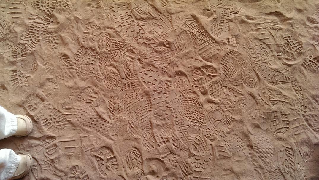
Footprints in the sand inside one of the tombs


Learning the family business


Marguerite Van Geldermalsen - author of "Married to a Bedouin", who runs a small stall inside Petra.
She talks about her life and the book here

The Lion Monument.

Exterior to the Soldier's tomb


Tomorrow we are back to the desert to excavate more features in our search for the archaeological imprint of the Great Arab Revolt 

Sunday, 3 November 2013

Day 6 - Fassuah ridge fort and the view to Batn Al-Ghul

Today the pictures tell much of the story.

The tent rings at the extended campsite at Batn Al-Ghul sit on a plateau at the height of the modern and Hijaz railway near to where the station would have been at the time of the Arab revolt. This station acted as a delivery point for men, animals, water, supplies and armaments to fortify and defend the line here. At a high point nearby on the ridge there is a large, well preserved fort, with extensive walling to delineate the boundaries, established firing positions, several now quite damaged buildings, a large area possibly for animals and several marked pathways leading between doorways into the buildings. This is Fassuah Ridge fort.


To the north there is a vast flat plain with many tent rings, mule lines, bread ovens and other features, and this landscape continues for a mile or so to the next station up the line at Aquabat Hijaz, where the phosphate now being mined is loaded into modern trains for transportation north and south . The most impressive thing about Fassuah ridge fort lies in the other direction however, and the images today reflect that. To the south the land drops away as the escarpment joins the high plain to the lower land below. This is the infamous Belly of the Beast - Batn Al-Ghul itself. The fort is perfectly situated with completely commanding views to the south. It's likely to have been used as a defensive position for centuries before being adopted by the Ottomans during world war 1.  Its strategic position is obvious, and the place itself and the views from it are genuinely inspiring.


Further down on the same level as the northern Ottoman camp lies the southern one, which has two clear lines of tent rings parallel to each other and running almost to the end of the plateau. This is the edge of the escarpment itself, with more sweeping views down into the wadi below.


Answering another question posed in the comments - those who have attended the GARP project as members over the past few seasons will recognise that yesterdays image posted here of our lunch represents a significant culinary improvement over many previous years. In the past it has been usual just to have flat bread, cheese triangles and unidentifiable cylindrical meat as the total extent of the lunchtime diet. The fact that we now have olives, humus, tomato and mustard, together with bananas is a truly revolutionary departure from historic fare. Who know what delights would be served were the project to continue for another 8 years!